Hiking in South Greenland
Jump to chapter
Published: 25/06/2020
Reading time: 6 minutes
There are a number of organized tours offered by several great operators in South Greenland. However, relatively well-marked trails and the absence of polar bears also gives you the option of setting out on your own on short hikes to explore this amazing landscape.
(Note: You can read more about most of these hikes plus a few others in my 2017 Greenland Hiking Summary blog post.)
Hiking Maps for South Greenland
I spent 2 weeks solo hiking near Narsaq, Igaliku, Qassiarsuk, and Narsarsuaq in 2017. The appropriate maps for these areas can be obtained from the Blue Ice Cafe in Narsarsuaq, Harvey Maps, or, you can do as I did, and rely on the information posted in the hostels in each settlement.
The hostels in Greenland are all amazing!

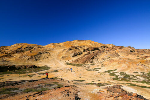
Hiking around Narsaq
There are several different tours that take in Narsaq and its surroundings. But if you find yourself in town with some time on your hands, there are 3 short and relatively easy hikes that you can do for yourself.
By far the most popular is the hike to the top of Tasiigaaq, the mountain that towers over the town. The trail up is steep but fairly obvious for the most part and is totally worth it for the spectacular views back down over Narsaq Bay.

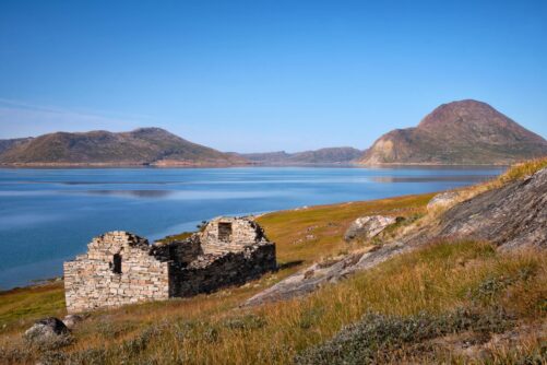
If you are interested in the Viking history of South Greenland, Landnama Farm – a Norse longhouse ruin from about the year 1000AD – is located near the edge of town. Or you can hike the opposite direction along the bay to see whether you have more success than I did at spotting ruins at Dyrnaes (a local guide might be a good option for this one).

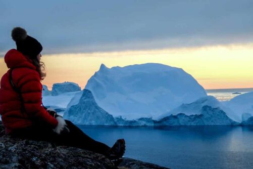
Dyrnaes is also a great place to just relax and, if you are lucky, watch an iceberg turn.

Another option is to keep hiking past Landnama Farm and follow the trail along the shore for great views up the Tunulliarfik fjord in the direction of Narsarsuaq. You can then return to Narsaq along the road or back along the way you just came.

Hiking around Igaliku
Igaliku is a beautiful settlement and was one of the most important sites in Greenland during the Norse era. Settled by Einer (Eric the Red’s best friend) in ~985AD, the parliament, court, and, once Christianity arrived, the Episcopal residence were all located here.

Several tours take in this sheep-farming community, but if you can factor in an extra day or two, there are a couple of nice day-hikes that you can choose from as well.
The Lake and Plateau hike is by far the most popular – a ~17km round trip out to a viewpoint over the Tunulliarfik Fjord and the Qooroq Glacier. This is a relatively easy hike that is fairly well signposted all the way to the lookout. Unfortunately, the markers are not as obvious if you choose to return through the “moon valley”, so if you are not confident with navigation, it might be better to retrace your steps.
The Waterfall Hike is another ~17km option. The main route takes you along roads that cut through sheep farms until you reach the river with the waterfalls. From there, you (carefully, the drop-off from the trail is very high) follow the river back to the Tunulliarfik Fjord and then follow the fjord all the way back to the King’s Highway and Igaliku.

Hiking around Narsarsuaq
Arriving in South Greenland you will likely have flown into the main international airport at Narsarsuaq. Many tours leave from this base, but there are also a few hikes that you can do directly from town.
The two very short hikes (less than 2 hours each) are to Signal Hill, a viewpoint located directly above town, and the Ridge hike which leads to a view over the river valley and Narsarsuaq Glacier. This latter is a very easy hike, and a wonderful opportunity to see a large variety of wildflowers during the summer months.

A longer hike (~16km) is out to the Narsarsuaq Glacier itself. This is a more challenging hike and not suitable for those who are worried about climbing steep, rocky slopes with uncertain footing. It ends with an amazing close-up view of the glacier, and you can actually hike down to the glacier itself if you wish. Just be very careful around the ice!

Important things to remember
There is no privately owned land in Greenland so you can wander wherever you wish. However, be respectful and keep these things in mind as you head out:
1) Leave no Trace. The first rule of hiking is to make sure that whatever you bring in, you also take out. Obviously, there are no garbage bins on any of these hikes, so make sure you take a plastic bag for your scraps and dispose of them when back in the settlement.
2) Let someone know where you are going. Especially if you are heading out by yourself, make sure someone knows where you are heading and when you expect to be back. It is an obvious thing, but surprisingly few people actually do this.
3) Bring a head net. If they find you, Greenland flies/mosquitoes are the most irritating things ever. And this is coming from an Australian who knows a thing or two about annoying flies! Make sure you bring a head net with you while hiking in South Greenland in summer or you are going to regret it!
- Read the article on everything you need to know about Greenland mosquitoes

How I arranged my trip in South Greenland
I arranged my 2 weeks of traveling independently in South Greenland with Blue Ice Explorer. They took care of all of the logistics including accommodation, boat transfers, and luggage transfers for only slightly more than it would have cost me to arrange it all myself. Highly recommended if you are used to traveling independently.
Read more travel blogs from Lisa Germany
More travel blogs


Popular tours
-
New Exiting Tour

Guided tour in Nuuk with UTV (Utility Terrain Vehicles) | Nuuk
Tour startsNuukDuration1.5 hours -
Authentic experience!
Expedition on Dogsled | 2 Days | Ilulissat
Tour startsIlulissatDuration2 days -
Small groups
Iceberg Safari with open boat | Ilulissat | Disko Bay
Tour startsIlulissatDuration2 hours -

Helicopter tour to the icefjord | Nuuk
Tour startsNuukDuration2 hours -
Morning Kayaking the Ilulissat Icefjord | Ilulissat | Disko Bay
Tour startsIlulissatDuration3 hours -
Accommodation and tours included!
Arctic Capital to Wilderness Escape | 4 Days in Nuuk & 2 Nights in Nuuk Icefjord Camp
Tour startsNuukDuration6 days -

Paradise Valley & Ice Cap Tour | Kangerlussuaq
Tour startsKangerlussuaqDuration70 minutes -
Explore Hvalsey Church Ruins | Qaqortoq | South Greenland
Tour startsQaqortoqDuration2 hours -
FLIGHTS FROM DENMARK INCLUDED!

8 Days of Autumn Wonders – Northern Lights and Icebergs | Nuuk & Ilulissat
Tour startsFrom CopenhagenDuration8 days -
Sermermiut Settlement Walk | Ilulissat | Disko Bay
Tour startsIlulissatDuration2 hours -
Arctic Desert Experience | Uummannaq | North Greenland
Tour startsUummannaqDuration2.5 hours -
1 TO 6 PASSENGERS INCLUDED

Northern Lights Private Boat Tour | Nuuk
Tour startsNuukDuration3 hours
Other interesting travel blogs